Life and work aboard the Research Vessel Roger Revelle. Photography by Alex Fox.
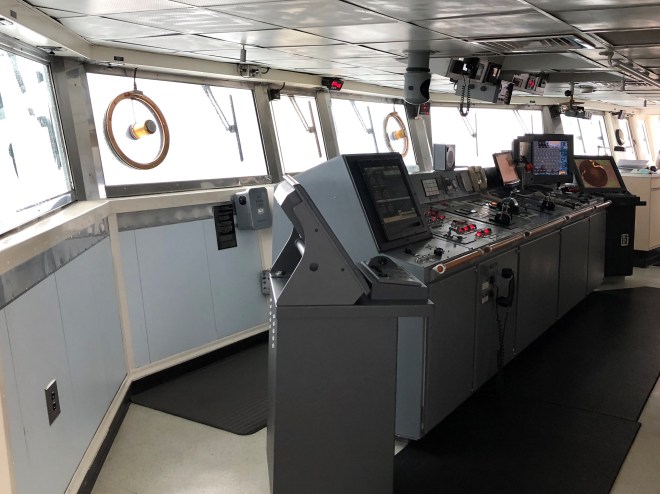
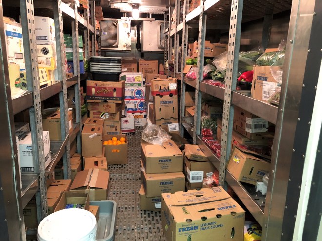
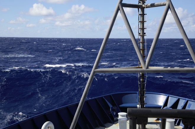
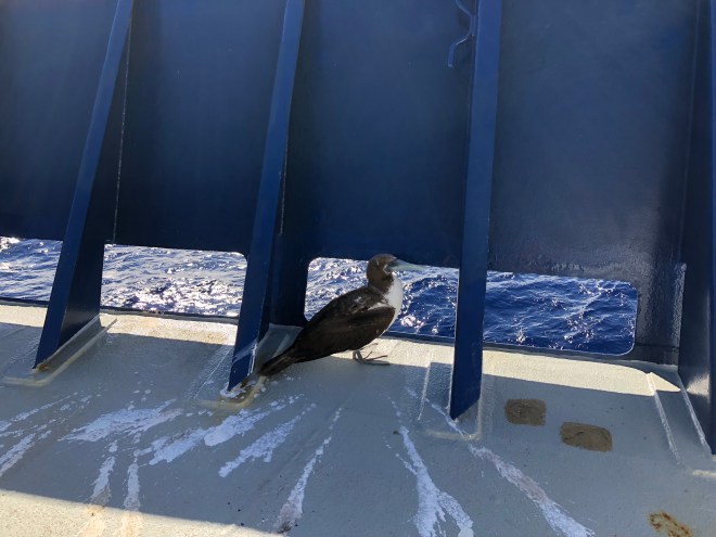
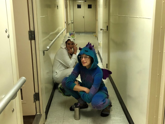
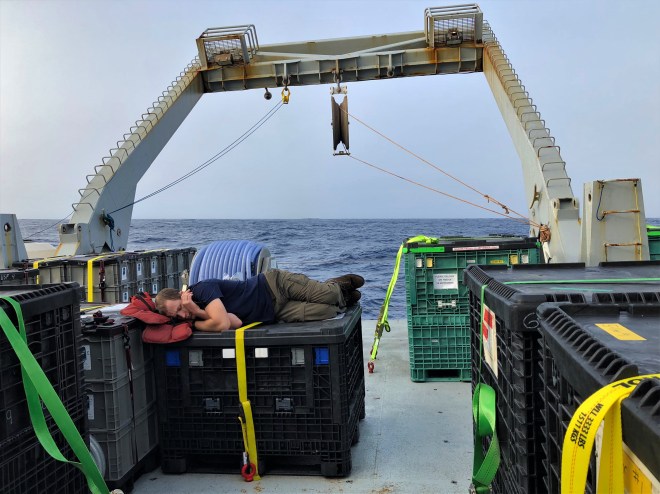
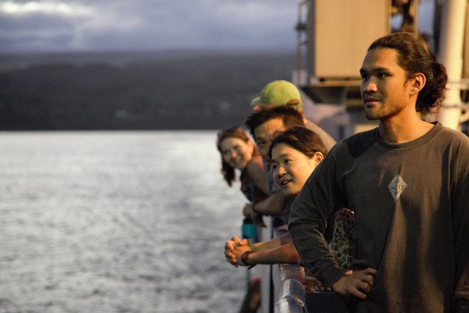
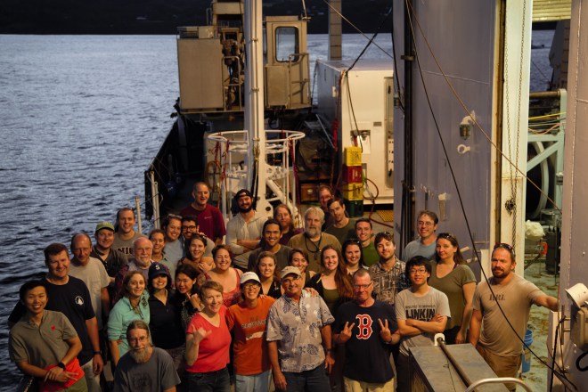
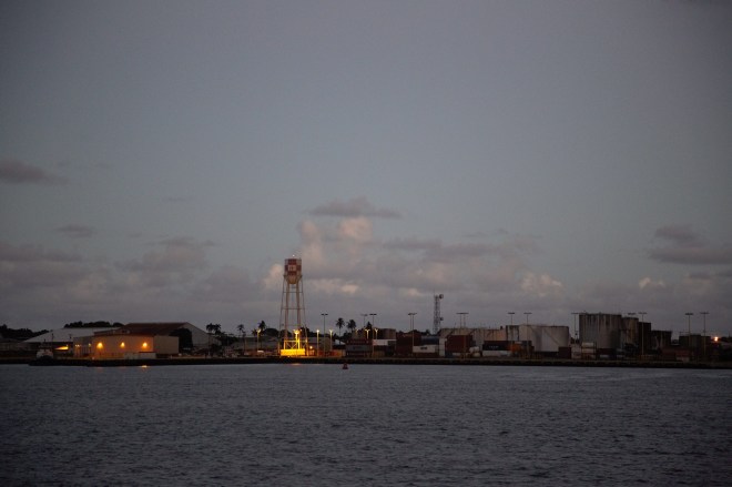
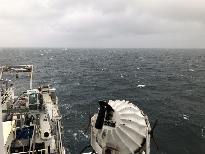
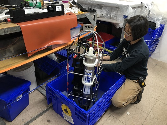
The bridge of the Roger Revelle.The ship’s stores hold all the food for 59 people for more than a month.Waves rise up above the bow of the Roger Revelle.An avian stowaway took up residence in the Revelle’s bow for several days.Clifton Buck of the Skidaway Institute of Oceanography with his equipment for sampling air and rainwater on GP15.Research technician Keith Shadle of the Scripps Institute of Oceanography on deck.Science on a 24-hour schedule sometimes requires a costume change to liven things up. Here a unicorn (Colette Kelly) and a dragon (Jennifer Kenyon) prepare to collect samples in the wee hours of the morning.Naps are essential in the world of GP15, where sleep schedules are secondary to the schedule of the ship’s scientific equipment. Here, Kyle McQuiggan finds a flat spot on deck.The optimal temperature for the Roger Revelle’s computers is on the chilly side. The computer lab stayed quite cool regardless of the conditions outside.Left to right: Paul Henderson of Woods Hole Oceanographic Institute, Phoebe Lam of University of California, Santa Cruz and Colette Kelly of Stanford University carry an ARGO float. Close to 4000 of these autonomous floats record oceanographic data throughout the world’s oceans.Colette Kelly of Stanford University sends an ARGO float on its way. Close to 4000 of these autonomous floats record oceanographic data throughout the world’s oceans.This tire softens any impacts while reeling in delicate scientific equipment.The tip of Hawaii, the first land GP15 had encountered in more than 30 days at sea.The landward rail attracts a crowd.The science party for leg 1 of GP15 assembles for a group photo just minutes from reaching port in Hilo.All 37 members of GP15’s science party stand together before arriving in Hilo, Hawaii.All 37 members of GP15’s science party stand together before arriving in Hilo, Hawaii.The port of Hilo emerges from the fog of more than 30 days on the Pacific.
GEOTRACES GP15 is supported by the National Science Foundation. Any opinions, findings and conclusions or recommendations expressed in this material do not necessarily reflect the views of the National Science Foundation.
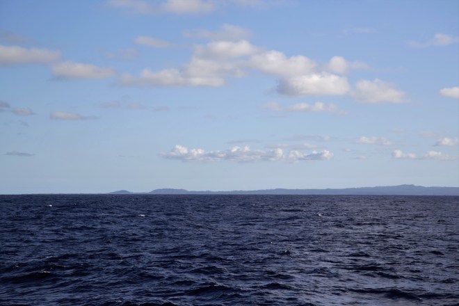
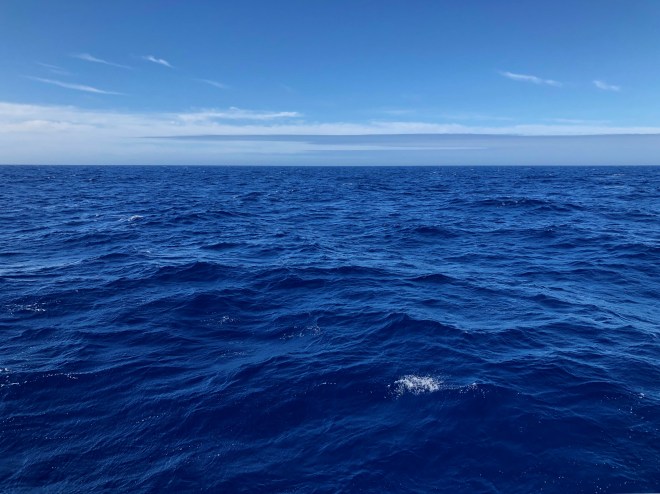
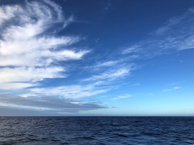
The sky and the sea seem endless in the open ocean. All photography by Alex Fox.
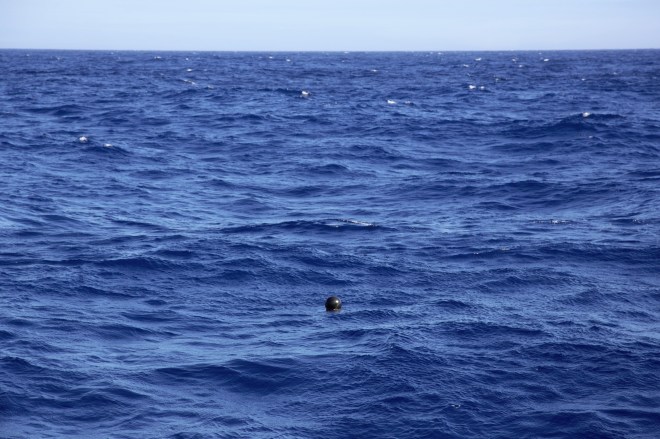
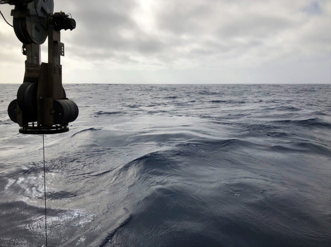
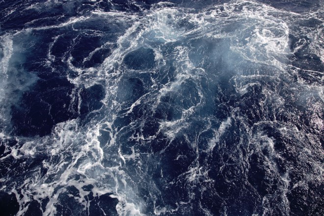
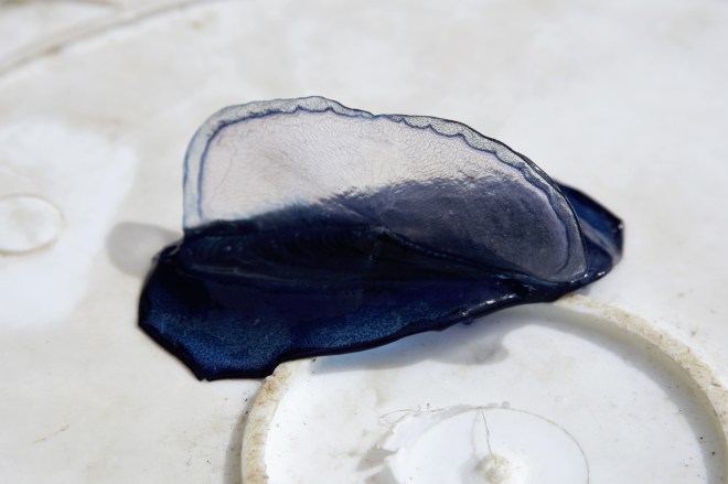
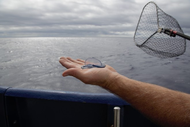
An albatross swoops above the Pacific.A wayward piece of fishing gear floats along in an expanse of blue.Clouds getting some color from the sunset.There are no shortage of vistas while at sea.Whitecaps as far as the eye can sea from the bridge of the R/V Roger Revelle.The R/V Roger Revelle’s winch arm lets out cable as the Pacific undulates beneath.The ocean takes on a bewildering variety of textures and colors over the course of a month.Blue.Sea and sky.The sun sets as the R/V Roger Revelle makes its way to our next station.The surface of the Pacific taking on a metallic coating as the scientists of GP15 search for iron, cobalt and manganese (to name a few).A piece of plastic pollution, perhaps a milk crate, floats by.Sunset or sunrise?A partial rainbow at sea.The engines of the R/V Roger Revelle can churn the ocean in some delightful ways.A fellow sailor. This is a velella, a small jellyfish that travels the surface of the ocean using its transparent sail to catch the wind.Captain David Murline holds a velella up to the horizon before releasing it back to the sea.
GEOTRACES GP15 is supported by the National Science Foundation. Any opinions, findings and conclusions or recommendations expressed in this material do not necessarily reflect the views of the National Science Foundation.
As the Research Vessel Roger Revelle sails the Pacific Ocean on its mission to study ocean chemistry, certain normal sounding words and phrases take on altered meanings. What follows is a list of 10 common words and phrases one might hear during GP15 along with their definitions. They are not presented in alphabetical order.
“Cruise”
These lines represent the many planned and completed GEOTRACES expeditions. Oceanographers typically call these scientific voyages cruises. Photo: GEOTRACES
In these blog posts, GP15 is mostly called an expedition, but when oceanographers talk to their colleagues GP15 is a cruise. Our outreach materials skip the word “cruise” because it makes it sound like we’re taking a vacation to Tahiti. GP15 is many things, but a vacation is not one of them.
“Station”
This is GP15’s cruise track. Each dot is a different station. Red dots are Super Stations, blue and purple dots are “full” stations, white dots are “demi” stations, the three brown dots are shallow or shelf stations and the green dots are places the Revelle will stop in port. Photo: GEOTRACES
Each dot along this map of GP15’s path is a station—someplace we will stop to take measurements and collect samples of seawater. The different colors indicate how many depths we will study at each station. Ocean chemistry varies dramatically with depth, so the chemical oceanographers of GP15 are always looking to collect water from a carefully selected set of depths. The most intensive stations are called Super Stations, and take roughly 56 hours to complete.
“Cast”
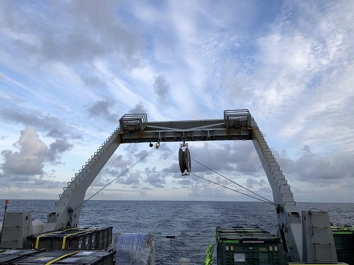
Moments before the start of a cast, scientific equipment is airborne above the Pacific Ocean. Next, it will be lowered thousands of feet down by a cable to study ocean chemistry. Photo: Alex Fox
Whenever one of the instruments on board the Research Vessel Roger Revelle goes into the water, it’s called a cast—short for hydrocast. Like fishers casting their bait into the ocean with a rod a reel, the oceanographers of GP15 attach their devices to cables to study the ocean from top to bottom. Some casts are quick, others take more than five hours to complete.
For most of GP15, the bottom is more than 16,000 feet down, and a majority of our stations call for samples from near the seafloor. A round trip to 3,000 feet takes about an hour, and that’s more or less without stopping. Some instruments need to be lowered deeper than 16,000 feet and remain there for hours collecting data.
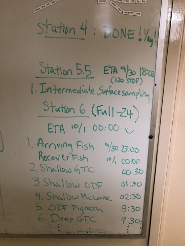
“The board of lies”
The whiteboard outside the main lab of the Roger Revelle shows the day’s schedule, but each day’s challenges result in frequent amendments and alterations. Photo: Alex Fox
Outside the main laboratory on the R/V Roger Revelle there is a whiteboard. This whiteboard is the subject of intense interest from the scientists of GP15 because it is where one of the chief scientists writes down the day’s schedule. The schedule tells everyone when they will be working and when they can sleep, eat or hang out.
However, there is a reason these schedules are written in dry erase marker and not etched in stone. They are subject to change. These changes can occur at any time, sometimes while the relevant parties are sleeping. The board strives to accurately represent the schedule, but its supreme authority combined with its unpredictability makes a certain amount of friction inevitable.
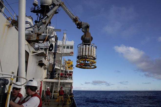
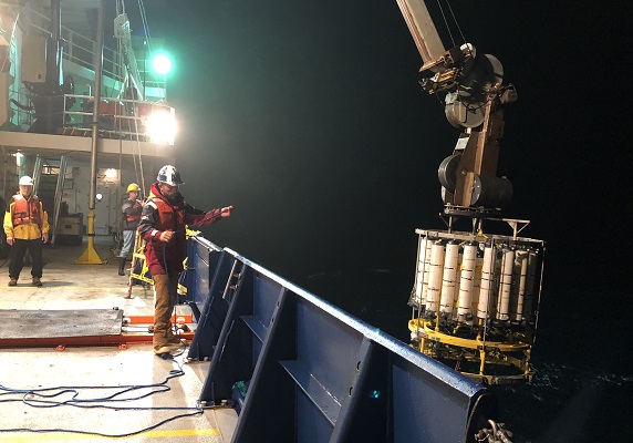
“CTD Rosette”
The trace metal CTD Rosette emerges from the ocean. Two tag lines are used to keep the CTD steady as it is reeled in. Photo: Alex Fox
CTD stands for conductivity, temperature, and depth. The measurement of electrical conductivity is used to determine the water’s salinity. Rosette refers to the ring of bottles attached to the cylindrical metal frame. The technology that measures conductivity, temperature and depth is nested in the center of the instrument’s metal frame, beneath the rows of bottles. Despite being composed of two separate systems it is often just called “the CTD.”
This key instrument is lowered into the ocean to collect seawater samples from various depths. On each cast the CTD’s rosette of bottles remain open on the way down, allowing water to pass through them freely. On the way back up, if the scientists of GP15 want a sample of seawater from a certain depth they can remotely trigger one of the bottles to snap shut—sealing the seawater inside.
GP15’s other CTD on its way down with its Rosette of bottles. Photo: Alex Fox
GP15 has two CTD Rosettes on board. One made specifically for studying trace metals without contaminating its samples, and the other is used to study less contamination prone elements of ocean chemistry.
“Bottles”
A row of bottles lines the wall of the ship’s hangar. Photo: Alex Fox
When oceanographers talk about popping bottles at sea they’re not planning a champagne-soaked celebration. The bottles of oceanography are devices that are used to bring samples of seawater back up to the surface. Their defining feature is the ability to be triggered from the surface to collect water from a particular depth. They can be used individually or they can be arranged in a ring as in a CTD Rosette.
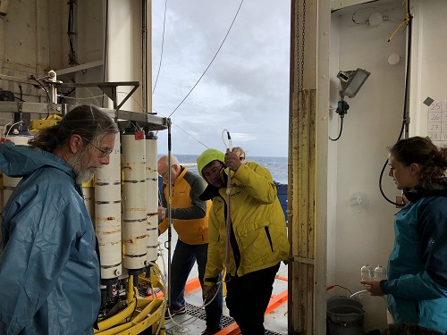
After spending hours underwater, the CTD returns from the ocean. Once it’s inside the hangar, the scientists of GP15 flock to it to collect seawater for their research. Photo: Alex Fox
When arranged in a ring around a CTD the bottles can be “fired” remotely from the ship’s computer lab, but in the case of a single bottle the old school method is to send what’s called a “messenger.” The messenger is a puck with a hole in it that snaps onto the cable the bottle is attached to, slides down the cable and triggers the bottle’s spring loaded lid like a mousetrap. Depending on the system being used, GP15’s bottles may hold 10, 20 or 30 liters of water.
“Pumps”
One of the in situ pumps of GP15 is raised out of the water after pumping seawater through its filters thousands of feet down. Photo: Alex Fox
Short for in situ pump, the pumps of GP15 use motors to push massive volumes of seawater through a set of filters designed to catch ocean particles for study. The in situ part of their full name means they do their pumping in the environment they’re studying, and in this case that means a specific depth at one of GP15’s stations in the Pacific Ocean.
Built around a metal frame, a pump’s main feature is a metal cylinder that can withstand the intense pressure 16,000 feet underwater. Inside the pressure case are a fleet of D-batteries that power the motor. Plastic tubes lead from the pump motor to the filters at the top of each pump that catch the particles the scientists are after. Each pump typically pumps for four hours at its chosen depth.
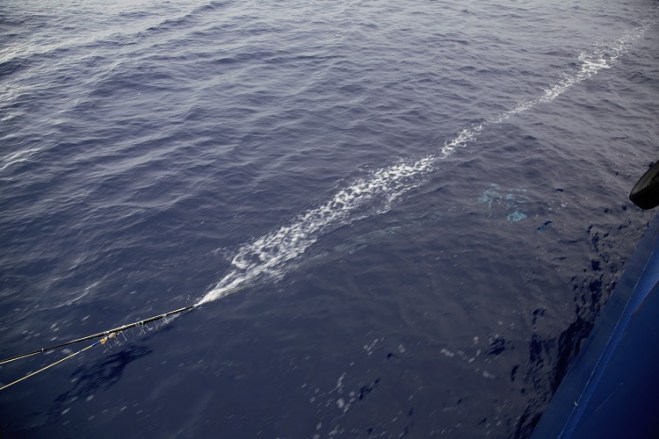
“Fish”
GP15 scientists wrangle the fish’s torpedo. The fish’s plastic tube is attached to a rope that carries the load as it swims beneath the surface. Photo: Alex Fox
The fish is not some unfortunate sea creature that the scientists of GP15 pressed into oceanographic service. The fish swims alongside the Roger Revelle while it is in transit from one station to the next. At its most basic level, the fish is a tube that pumps seawater from the ocean’s surface back to the Revelle’s laboratory. It earns its piscine moniker by way of a torpedo that swims the tube below the surface and away from the moving ship.
The fish swims alongside the R/V Roger Revelle at a depth of around 15 feet. Photo: Alex Fox
The purpose of the fish is to deliver water samples from the ocean’s surface for trace metal analysis. The fish swims while the Revelle is underway to ensure the water it pumps is fresh and uncontaminated by the Revelle’s metal hull.
“Vans”
This van is responsible for processing samples from the trace metal CTD Rosette. These samples can easily become contaminated, which is why the van is a designated “clean room.” Photo: Alex Fox
On GP15, if someone invites you inside their van there’s no reason to get nervous. On GEOTRACES expeditions a van is a shipping container with a laboratory inside it. After a trip across the country to reach Seattle, WA where GP15 began, the crew of the Roger Revelle bolted the vans to the ship’s deck. GP15 has four vans, each specialized for a different type of oceanographic research. The vans provide crucial lab space to the 37 scientists of GP15 and also provide a little extra shade on deck.
The bubble is a capsule of cleanliness for studying samples prone to contamination from the ship environment. Its walls are made out of sheets of plastic and a group of large air filters fill the bubble with clean air like a balloon. The bubble would pop, but, instead of doors that seal shut, it has flaps. The flaps allow clean air to slowly escape and, in the process, this slight outward pressure keeps contaminants from blowing in.
GP15 blog posts written by Alex Fox unless otherwise stated.
GEOTRACES GP15 is supported by the National Science Foundation. Any opinions, findings and conclusions or recommendations expressed in this material do not necessarily reflect the views of the National Science Foundation.
In the middle of the northern Pacific Ocean, the scientists of GP15 encountered a shadowy relic of the marine realm: the oldest seawater on the planet. This blob of ancient water last touched the surface during the peak of the Maya civilization in modern day Mexico and Central America—roughly 1,200 years ago. Shrouded in darkness, this blob is loaded with nutrients like nitrogen and phosphorus, but it’s also acidic and oxygen-depleted compared to most of the ocean.
Once this water lost contact with the atmosphere, oceanographers started counting its birthdays. “So much happens when water is at the surface—gases in the air are exchanged and nutrients like nitrogen get sucked up by plankton,” said Co-chief Scientist Phoebe Lam of the University of California, Santa Cruz.
The CTD Rosette, just before spending hours lowering to more than 16,000 feet underwater. As the winch reels it back in, scientists on board the Research Vessel Roger Revelle trigger its bottles to snap shut at certain depths to collect seawater for analysis. This is one of the chief instruments by which they will study the oldest water in the oceans. Photo: Alex Fox
This water sits around 6,000 feet down and isn’t even close to being the world’s deepest. That title is currently held by a 36,070-foot deep chasm called Challenger Deep that lurks within the already unfathomable Mariana Trench in the western Pacific. Yet, even the waters of Challenger Deep, more than 7,000 feet deeper than Mount Everest is tall, return to the surface faster than GP15’s aged quarry.
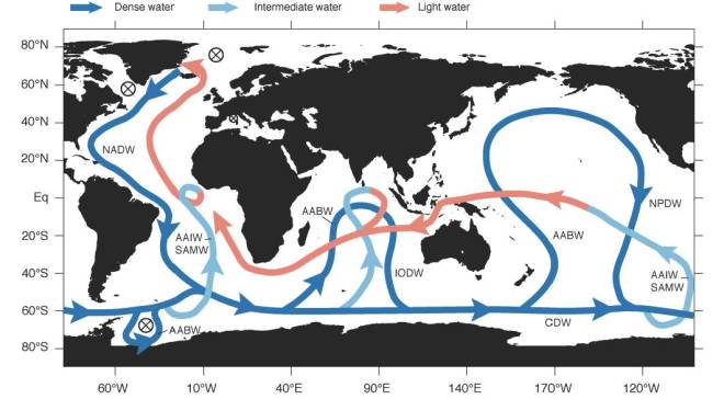
A long, dark trip
Stale but well traveled, this water’s thousand year journey began on the surface of the north Atlantic. After years drifting north and baking in the subtropical sun, evaporation turned the water’s upper layer briny. Near Greenland, things cooled off. Becoming saltier and colder increased the water’s density compared to its neighbors, causing it to sink.
The dark blue line traces the “conveyor belt” of deep water around the world. GP15’s station 12 intersects this ribbon of old, deep water in the north Pacific Ocean at 37 degrees North, 152 degrees West. Image: Sarmiento, Jorge and Nicolas Gruber, “Ocean Biogeochemical Dynamics.” Princeton University Press, 2006.
This dense combination of extra cold and salt sank the water to around 6,000 feet where it climbed aboard what oceanographers call, “the conveyor belt.” The conveyor belt is a one-way procession of deep water that travels around the globe. The explanation for every twist and turn of the belt is still the subject of active research, but density is generally accepted as a driving force.
The belt ferries its most stagnant passengers to a dead end, called the “shadow zone,” in the north Pacific. This is where GP15 encountered these dank waters.
The shadow zone is a clump of water almost totally cut off from the surface, an amorphous purgatory of nearly motionless water. Above and below the shadow zone are waters of contrasting densities that lock it in place. Its only escape is being pushed out as “new” thousand-year-old water seeps in.
An elementary history
“This old water carries a chemical history of all the ecosystems it flows under,” said Casciotti. “It’s called the conveyor belt because all these nutrient-rich particles fall onto it, get broken down and their nutrients get carried to the north Pacific.”
But being cut off from the sun and the atmosphere has chemical consequences. The oldest seawater’s oxygen content is low—microbes used it to decompose organic matter like whale poop. All these microbes chowing down in turn release carbon dioxide, which forms carbonic acid and makes the water more acidic. But it’s not all bad news for living things, because the longer this water is cut off from the surface, the longer it has to accumulate nutrients. Near the surface, those nutrients would get snapped up, but deeper down when microbes run short on oxygen and food nutrients like nitrogen and phosphate build up.
The conveyor belt chugs along beneath a multiplicity of ocean environments, collecting chemical clues from each that the scientists of GP15 can use to understand the marine environment. Photos: Alex Fox
Flash forward a thousand years, and the result is a deep sea stew of nutrients. This larder of rotten ocean helps supply the booming sea life of the north Pacific. Off the coasts of places like Seattle and San Francisco these nutrient-laden waters are swept up from the deep by wind in what’s known as coastal up-welling. At the surface, those nutrients fuel huge blooms of phytoplankton that form the base of an ocean buffet.
What about climate change?
The western U.S. seafood industry is built on this old, deep water, but climate change is turning this already acidic brew caustic. The more carbon dioxide humans pump into the atmosphere the more carbon dioxide the oceans absorb, and this means more carbonic acid. Along the west coast, ocean acidification is forcing longstanding oyster farms to treat their seawater to keep the baby shellfish from dissolving in the saltwater acid bath.
Downtown Seattle in the rear view of the Research Vessel Roger Revelle at the start of GP15 on September 18. Photo: Melissa Miller
So far, climate change hasn’t exerted much influence on the size, speed or direction of the conveyor belt, but it’s not outside the realm of possibility. “The rate of the conveyor belt has changed in the past,” said Lam. “During the last ice age it’s thought to have become more sluggish.”
In what might generously be described as a Hollywood blockbuster, the 2004 movie The Day After Tomorrow imagined what might happen if climate change caused this huge ocean process to grind to a halt. In a span of days, a tidal wave hits New York City, super storms the size of continents appear and much of the Northern Hemisphere descends into an ice age.
“The real life version of The Day After Tomorrow scenario is that rising global temperatures melt glaciers in northern Canada and Greenland, sending lots of fresh water into the system,” said Lam. “Because this water isn’t salty it doesn’t sink, which in theory could shut down the conveyor belt’s north Atlantic source of deep water and make things pretty chilly in Europe.”
Crucially, this sort of shift would play out across years or decades, rather than days as it does in the film. Oceanographers have been looking for changes in ocean circulation, but only hints have emerged thus far, according to Lam.
Checking their work
A litany of ocean processes accumulate in this ancient, deep water. Dissecting its chemistry offers an opportunity to fine tune oceanography’s understanding of these cycles. Do current models correctly predict what shows up at the end of the line? What about rare elements that are also necessary for life like iron? “This water helps you check your work,” said Lam. “We’ve got ideas of how various trace elements and isotopes behave at this scale based on limited data, but now we’re putting it to the test.”
Whether it’s 3 a.m. or 3 p.m., the return of the CTD Rosette turns the hanger into a hive of scientific activity—each researcher vying for their share of the seawater contained in its 36 bottles. Photo: Alex Fox
This antique slurry lets GP15’s scientists reach beyond their GPS coordinates to capture the life and times of the chemical ocean.
“Where iron and other trace elements are getting on and getting off the conveyor belt isn’t well understood,” said Casciotti. “There is a lot we still don’t know. Bringing this water back to the lab is exciting.”
GP15 blog posts written by Alex Fox unless otherwise stated.
GEOTRACES GP15 is supported by the National Science Foundation. Any opinions, findings and conclusions or recommendations expressed in this material do not necessarily reflect the views of the National Science Foundation.
The 37 scientists aboard the Research Vessel Roger Revelle left Seattle, WA on September 18 with a plan—a guiding melody for their 67-day GEOTRACES study of ocean chemistry. A few days at sea and three tests of the scientific equipment later, Chief Scientist Greg Cutter and Co-chief Scientists Karen Casciotti and Phoebe Lam changed their tune.
The plan, four years in the making, was to begin at Station 1 off the coast of Alaska. The expedition, code-named GP15, would instead begin with the deep water Station 5—instruments lowering to depths of more than 15,000 feet instead of less than 300 feet on the Alaskan shelf.
“Station 1 is in shallow water, which is more stressful for everyone—nobody wants their gear bouncing off the seafloor,” said Cutter of Old Dominion University in Norfolk, Virginia. A veteran of countless oceanographic expeditions, Cutter helped start the GEOTRACES program in 2001.
The increased risk of impacting the seabed in shallower water is due to the strong currents that often occur near shore. Currents can push expensive equipment into uphill slopes or cause it to take a nerve wracking diagonal route to the bottom. By comparison, the water scarcely moves thousands of feet down.
After a placid first few days at sea, the wind and waves intensified as the Revelle motored northwest to Station 5. The precipitous rise and fall of the ship had some reaching for their seasickness medication.
The frothy North Pacific Ocean made for a bumpy ride. Photo: Alex Fox
The Revelle arrived at 11 p.m. Forty mile per hour winds stacked the swells up to 10 feet high—not that anyone could see them in the dark. Walls of water occasionally emerged from the blackness, soaking the deck and everyone on it.
Co-chief Scientist Lam’s group from the University of California, Santa Cruz lowered their carefully calibrated instruments, used to collect and detect particles in the water, at 2 a.m. Deep water or not, Lam was concerned about her delicate sensors impacting the bottom.
“This instrument doesn’t tell you how deep it is in real time,” said Lam. “Instead we have to mostly rely on the winch’s display to tell us how much cable it has let out—it makes me nervous.”
After a tense transit thousands of feet below the surface, Lam’s gear appeared to be around 100 feet off the bottom. The equipment did its job, pumping seawater and filtering out particles for study, for the prescribed four hours.
But the winch had under-reported its unspooled cable, and Lam’s equipment returned with deep sea mud packed into its crevices, mementos from an encounter with the bottom. After years of planning, Lam was terrified she broke her instrument on the first station, less than a week into a 67-day expedition.
Co-chief Scientist Phoebe Lam cleans mud from more than 15,000 feet under the sea off of her instrument in a makeshift bathtub. Photo: Alex Fox
“I was feeling so good,” recalled the normally upbeat Lam. “I had just had a birthday at sea, I even saw the green flash for the first time.” GP15 is also Lam’s first as one of the Chief Scientists on board. The potential loss of this instrument would be a blow not just to her own science but to the overall success of an expedition she is partly responsible for managing.
Not one to bog down in dismay, Lam spent the better part of the following afternoon giving her device a bath and then carefully re-calibrating its sensors. To her great relief, the extra TLC paid off and her instrument came back to life.
A wave of relief registers on Co-chief Scientist Phoebe Lam’s face as she realizes her instrument is merely damaged, not irreparably broken. Photo: Alex Fox
More than 24 hours after stopping at Station 5 the Revelle moved on to Station 1, which went smoothly despite the shallow water.
Leaving Station 1, near the island of Aghiyuk, the weather again asserted itself. At Station 2, the swell heaved the Revelle up and down, while one of the expedition’s key instruments, called a CTD Rosette or CTD for short, was hundreds of feet underwater.
In the troughs of the slate colored waves the cable went slack, and when the ship rode the next swell back up the cable snapped taught. The cable held, but Chief Scientist Cutter was worried the jags of tension could damage the link between the ship and the instrument he helped design. On GP15, Cutter alone operates the winch controlling the trace metal CTD’s trips to and from the deep. The winch’s roughly 26,000-foot cable not only tethers the CTD to the Roger Revelle but also powers its instruments and allows it to relay information to computers on board.
Trace metal CTD technician Kyle McQuiggan carries one of the bottles used to trap seawater for study. Photo: Alex Fox
The CTD measures salinity, temperature and depth, and its rosette holds a ring of bottles that can be remotely triggered to snap shut and collect water from various depths. This particular CTD is used to measure trace metals. These elements, some essential and others toxic to marine life, are exceedingly rare. To measure these scarce materials, the CTD must be kept scrupulously clean, lest the instrument contaminate its own samples. If there is a core to what makes a GEOTRACES expedition, this instrument is part of it.
Inside the computer lab, CTD technician Kyle McQuiggan saw the green, blue, red and yellow lines that chart the CTD’s measurements become scatological abstractions—a beeping, red error message the cherry on top.
Cliff Buck, of the University of Georgia, pitches in by wrangling lassos of cable from the offending winch in the stinging rain. Photo: Alex Fox
Somewhere between the CTD and McQuiggan’s monitor, there was a problem. What if the spikes of tension allowed seawater to sneak past the Kevlar surrounding the power cable? McQuiggan and others removed huge lengths of cable, checked them for weaknesses and then spliced them back together with yards of electrical tape.
Hours later, the refurbished wire was reconnected, but the error message remained. Meanwhile, the Revelle bulldozed through the waves and wind on its way to Station 3. The failure of the previous hours of work to remedy the CTD cable called into question whether the cable was the problem at all.
Cutter and McQuiggan stood in the computer lab around 8 p.m., the portholes painted black by the night, discussing what to do next. Much of the science party was running on only a few stolen hours of sleep after three solid days of work.
Exhaustion sharpened the edge of their frustration at the lost efforts of the afternoon. According to the ship’s captain, even worse weather lay in the path of the Revelle. With one of the expedition’s most crucial instruments offline, charging into swells that might top 15 feet held little allure.
The expedition leaders and the ship’s captain opted to hide out in the lee of an island called Chirikof until the CTD could be repaired. Everything was on hold: the expedition’s 26 research projects frozen and the Revelle stopped in its tracks. Outside the shelter of the island, 50 knot winds whipped the ocean into a range of snow capped peaks.
Calderwood and Gum put their heads together in the computer lab. Photo: Alex Fox
Cutter and McQuiggan called in technicians Joseph Gum and John Calderwood. Outside of the team assembled to fix the trace metal CTD, most of the science party was on their way to sleep—trying to stock up before the Revelle reached Station 3.
The added expertise winnowed the list of suspects down to the winch’s slip ring. The slip ring is where the ship and the winch’s thousands of feet of cable connect. It’s called a slip ring because it spins in place without tangling the wires leading back to the ship as the winch lets out or takes in cable.
Saltwater must have found a way in and corroded the connections, Gum explained. The corrosion caused volts to spill out across the wires meant to send data back to the ship, producing the rainbow Rorschach on McQuiggan’s monitor.
Left to right: CTD technician Kyle McQuiggan, Research Technician Keith Shadle and multi-talented Data Analyst Joseph Gum work together to fix the winch. Shadle holds the broken slip ring. Photo: Alex Fox
The faulty slip ring had to be replaced with some stand-in from the limited cast of characters on board the Revelle. After a scavenger hunt through the ship’s machine shop, another slip ring materialized, but it was the wrong size.
On land, a phone call or the click of a mouse could summon the perfect replacement. At sea, “the perfect replacement” is anything that does the job. The new slip ring was too small, but the machine shop had the tools to drill out new holes to make it work—specificity supplanted by ingenuity. “It’s all paperclips and duct tape when you’re at sea,” said Cutter.
After nearly 16 hours of work, McQuiggan, Gum, Calderwood and Shadle installed the new slip ring around 3 a.m. The Roger Revelle left its island refuge and turned south—ready for whatever came next.
GP15 blog posts written by Alex Fox unless otherwise stated.
GEOTRACES GP15 is supported by the National Science Foundation. Any opinions, findings and conclusions or recommendations expressed in this material do not necessarily reflect the views of the National Science Foundation.
“GP15” is the code name of this GEOTRACES research expedition from Alaska to Tahiti. GP15 draws a vertical line down the middle of the Pacific Ocean at longitude 152° West. The 67-day voyage aboard the Research Vessel Roger Revelle spans more than 5,000 miles of ocean.
Clouds off the stern of the Research Vessel Roger Revelle near Vancouver Island. Photo: Alex Fox
This expedition is a study of extremes. It begins collecting samples of seawater in the marine equivalent of a rainforest and ends in an underwater desert.
The path of GP15 along longitude line 152° West. Each dot represents a station where the expedition will pause to collect samples. The different colors indicate how many measurements must be retrieved from each station. Red dots are “Super Stations,” which take multiple days to complete. Blue and purple dots are different kinds of “Full Stations,” typically requiring 24 or 36 hours. White dots are “Demi-Stations,” that can be completed in less than a day. Finally, green dots are places the R/V Roger Revelle will stop in port. Image: GEOTRACES
The waters off Alaska are filled with microscopic plants called phytoplankton. They are what drive Alaska’s productive fisheries and are the dinner bell to which giant whales are drawn. But phytoplankton depend on abundant nutrients like nitrogen and rare trace nutrients like iron to turn the sun’s energy into food. GP15’s investigations will probe where exactly those nutrients and others can be found, how abundant they are and where they’re coming from.
Tahiti may be known for rainbow studded coral reefs, but the ocean surrounding those reefs is crystal clear precisely because it is so devoid of nutrients. Without abundant nutrients, phytoplankton become scarce and different ocean processes come into play, all of which will be captured by GP15’s samples.
A sunset at sea from the bridge of the Roger Revelle. Photo: Kenneth Olsen
Bookended by these two divergent undersea ecosystems, GP15 will chart how one extreme transforms into the other. Along the way, the 37 scientists aboard the Roger Revelle will sample water that hasn’t seen the sun in 1000 years, pass by hydrothermal vents—thought to be a potentially significant source of iron—and skirt a hotbed of deep sea mining activity.
Deep sea mining has the potential to stir up toxic trace elements, and this GEOTRACES expedition is perfectly positioned to take a chemical snapshot of these waters before any underwater excavation begins. An unbiased baseline of the area’s ocean chemistry will ensure that the environmental impacts of deep sea mining can be laid bare.
Members of the science team work around the clock to make the most of GP15’s time at sea. Photo: Alex Fox
The data collected on GP15 will complement the findings of the last GEOTRACES expedition, conducted in 2013, from Peru to Tahiti—the horizontal to GP15’S vertical line.
At a time when the world’s climate is changing ever more rapidly, the oceans remain a bellwether. The oceans absorb more and more carbon dioxide and heat every year, and unless large scale studies like GP15 continue, the consequences may blindside humanity.
GP15 blog posts written by Alex Fox unless otherwise stated.
GEOTRACES GP15 is supported by the National Science Foundation. Any opinions, findings and conclusions or recommendations expressed in this material do not necessarily reflect the views of the National Science Foundation.
“Events and processes in the ocean leave behind chemical clues. GEOTRACES is about finding them, using them to reconstruct what happened and, ultimately, better understand how the world works.”
Members of the GEOTRACES GP15 science party and crew coordinate deck operations aboard the Research Vessel Roger Revelle en route to Alaska. Photo: Alex Fox
The clues GEOTRACES focuses on are called trace elements and isotopes. These chemicals can be nutrients, tracers of current and past ocean processes or contaminants from human activity. Where they go and how long they take to get there impacts the global climate as well as the ocean ecosystems humans depend on.
GEOTRACES scientists hunt down these clues on oceanographic research expeditions all over the world. Scientists from 35 countries have contributed to the program. The expeditions crisscross the globe along carefully considered routes designed to capture the full range of ocean conditions—from deep to shallow and from huge plankton blooms to turquoise marine deserts.
Yellow lines represent completed expeditions, red lines are planned expeditions (including GP15) and black lines are expeditions completed as part of a collaboration with another research program. Image: GEOTRACES
Reconstructing ocean events and cycles from the chemicals in seawater requires knowing how much of some element can be found in a given part of the ocean, but also figuring out how it got there and where it’s going. Understanding what drives the existing patchwork of elements in the ocean can also allow scientists to predict how those patterns and cycles might change in the future.
Another distinguishing feature of GEOTRACES research expedition is that they study a wide range of trace elements and isotopes all at once. “With GEOTRACES you have all these different scientists measuring very specific things, and they’re important, but when you join all the data together the whole is much greater than the sum of its parts,” says Chief Scientist Greg Cutter of Old Dominion University. The full suite of measurements provides context that allows for a richer interpretation of any one stream of data.
Despite knowing how important these chemicals are to marine life, in many cases little is known about where they come from, where they’re going, how they get there and what chemical reactions occurred along the way.
GEOTRACES attacks this knowledge gap by studying the distribution and movement of these key trace elements and isotopes at the global scale.
What are trace elements?
Trace elements are rare by definition, but some trace elements are essential nutrients for living things while others are toxic. For example, both humans and phytoplankton, the microscopic marine plants at the base of the ocean food web, need iron. Without iron, humans become anemic and phytoplankton can’t use sunlight to grow. On the other hand, heavy metals like lead or mercury are toxic.
Chief Scientist Greg Cutter secures the GEOTRACES CTD Rosette, one of the most important instruments on board. Photo: Alex Fox
“We’re interested in what controls the delivery of those nutrients, because they can help us understand why there are huge booms of marine life in some places but not others,” says Casciotti.
In the ocean, iron can be the difference between a saltwater desert and a feeding bonanza complete with whales, fish and seabirds. On the global scale, the presence or absence of these rare nutrients limits how much life the oceans can support and helps determine where it is found.
This has very real consequences for humans as well as whales and fish. A productive year in the oceans could mean a boost to the global fishing economy, but it also helps determine how much carbon dioxide is absorbed by the oceans each year.
Pacific white-sided dolphins take flight alongside the Research Vessel Roger Revelle. Photo: Kevin Cahill
When phytoplankton turn sunlight into food they suck up carbon dioxide, one of the primary greenhouse gases contributing to climate change. But phytoplankton also need iron to make the chemical reaction, called photosynthesis, go. An ocean full of carbon dioxide is no use without iron. By limiting the amount of carbon dioxide phytoplankton can use for photosynthesis, trace elements like iron can influence global climate.
The importance of trace elements as nutrients is well established, but where they are and how they got there is in some cases a mystery. To trace the path of these essential trace elements chemical oceanographers can use isotopes.
What are isotopes and what do they have to do with oceanography?
Many elements on the periodic table have isotopes—atoms with the same name and chemical properties, but different masses. Their non-standard masses make them distinctive and allow them to be picked out by scientists looking to do some chemical detective work.
The scientists of GP15 each collect their share of seawater brought up from the depths by the CTD Rosette. Photo: Alex Fox
When isotopes are radioactive, they can be used like stopwatches. Their predictable rates of decay allow scientists to infer how long it took the radioactive isotope to get where it is or how long it has been there.
Other isotopes can be used like fingerprints that identify their source. For example, certain isotopes only come from underwater cracks in the earth’s crust called hydrothermal vents.
A third use of isotopes is as a way of tracking chemical or biological processes. For example, some organisms prefer one isotope over another. So, if an oceanographer sees a certain ratio of isotopes in the water, it tells them something about what various marine critters are up to.
GEOTRACES seeks to establish the distribution of key trace elements and isotopes in the ocean while also uncovering the processes that brought them there. This approach has the power predict the patterns of marine life these elements underpin, as well as the ocean’s responses to our rapidly changing world.
GEOTRACES GP15 is supported by the National Science Foundation. Any opinions, findings and conclusions or recommendations expressed in this material do not necessarily reflect the views of the National Science Foundation.
The 277-foot R/V Roger Revelle is the home, laboratory and transportation for the 59 scientists and crew studying ocean chemistry between Alaska and Tahiti.Here the Revelle sits in port at Smith Cove in Seattle, WA, while all was made ready for more than two months at sea. Photo: Alex Fox
At noon on September 18 the Research Vessel Roger Revelle set sail, and a journey of more than 5,000 miles began. Over the prior four days, more than 50 scientists and crew worked together to pack the nearly 300-foot Revelle to the gills.
Crates upon crates waiting to be loaded on the R/V Roger Revelle in Seattle’s Smith Cove. Photo: Alex Fox
Organizing chaos
Cranes, forklifts and muscle lifted 88 full pallets of equipment on board for the 67-day oceanographic expedition from Alaska to Tahiti. Three shipping containers converted into laboratories now sit where there was once empty deck. Down below, narrow hallways and steep staircases lead to a hive of workstations devoted to different types of analysis. The scientific equipment on board supports 26 separate research projects from 25 of the nation’s leading research institutions.
Scientists and crew will lower many of the key instruments on board to the bottom of the ocean. On their way back up, some instruments collect seawater while others measure things like the water’s temperature and salinity. To manage these deep sea dunks, the Revelle is packing roughly 95,000 feet of cable attached to four huge winches—more than three times the height of Mount Everest (29,029 feet).
Some samples hauled up from the depths need lab space free of potential contaminants to be accurately measured. Creating such a space on a ship that is decidedly not free of contaminants requires a lot of plastic, tape and an array of air filters.
One of the doors to the clean room in the main lab flaps open, and a transparent plastic window adds a homey touch to the sterile environment. Photo: Alex Fox
Scientists build these clean rooms, called “bubbles,” with walls of plastic that balloon out with the clean air the filters are pumping in. That air escapes through the door flaps of the bubble and the slight pressure of leaking air helps keep wayward gunk from getting in.
On such a long expedition and with so many people on board, everyday details like food are writ large.
A handful of the 12 pallets of food the ship’s crane hoisted on board. To get the boxes of food down to the ship’s fridge, freezer and storage rooms all hands on deck formed a human conveyor belt. Photo: Alex Fox
Twelve pallets stacked six-feet high took more than three hours and all hands on deck to bring down to the ship’s refrigerator, freezer and dry food storage rooms. The cost of all that food topped $43,000. That total may seem astronomical, but, spread across 59 people and 67 days, each person’s daily share of food is $10.87.
At 11:30 a.m., over the loudspeaker the captain called out, “All ashore who’s going ashore!”A flurry of trash bags and cardboard boxes flew over the ship’s rails into a nearby dumpster and a few stragglers made their escapes.
Then one of the ship’s cranes lifted the gangway plank leading from dry land to the floating Revelle. The 20-odd-feet of steel rose lightly off its hinge and pirouetted into parallel with the ship’s side where it was secured in place.
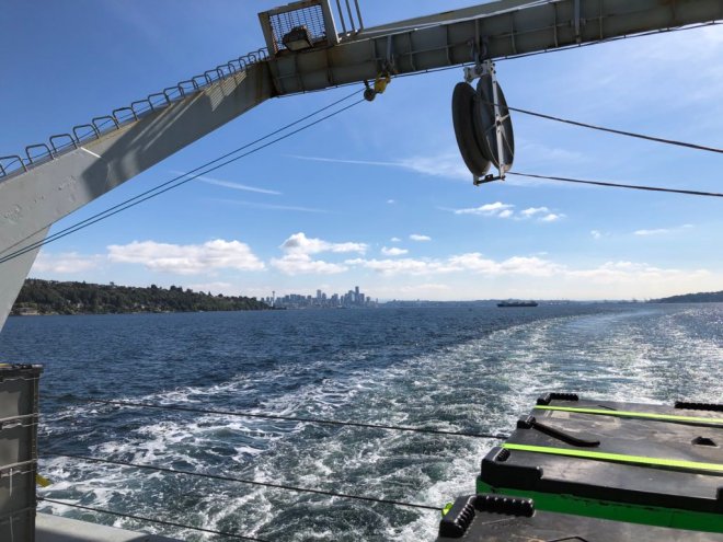
Seattle fades into the distance as the R/V Roger Revelle motors full steam ahead at 12 knots on September 18. Photo: Alex Fox
The 59 people on board prepared for the next month living and working together to better understand the Pacific Ocean, and thick ropes were untied and thrown back to the Revelle. After days of intermittent rain in Seattle, the noonday sun burned through to blue sky and lit the way out of Puget Sound.
GP15 blog posts written by Alex Fox unless otherwise stated.
GEOTRACES GP15 is supported by the National Science Foundation. Any opinions, findings and conclusions or recommendations expressed in this material do not necessarily reflect the views of the National Science Foundation.